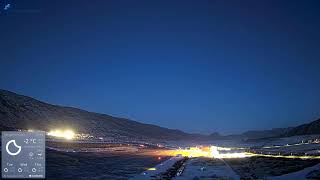


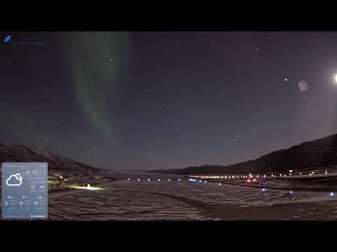


This live stream shows the western approach to Kangerlussuaq Airport (SFJ), Greenland's main Arctic gateway. The camera captures the runway, taxiways, and surrounding tundra, offering views of aircraft operations and Arctic scenery. Located at the head of Søndre Strømfjord, the airport is a hub for international flights and Arctic research, originally established as a U.S. Air Force base during World War II.
Kangerlussuaq, Greenland

Kangerlussuaq is a settlement located in the Qeqn district of the Kalaallit Nunaat municipality in eastern Greenland. It is situated approximately 30 kilometers (19 miles) upstream from the mouth of the Kangerlussuaq River, near the ice sheet margin. The settlement lies at the northern end of a long, narrow fjord that connects to the ocean.
Kangerlussuaq was a major Greenlandic ice core drilling site, and it hosts the now-defunct Kangerlussuaq Airport, which was previously used for commercial and military flights. The settlement is known for its unique location, where the ice sheet meets the fjord, creating a spectacular landscape. The area is also notable for its scientific research, particularly in the fields of glaciology and climate change.
The settlement has a relatively small population and is not a major commercial center. Kangerlussuaq is primarily known for its scientific significance and its role as a gateway to the Greenland ice sheet. The area offers opportunities for hiking, camping, and exploring the Arctic wilderness.
Kangerlussuaq's climate is characterized as a polar climate, with long, cold winters and short, cool summers. The settlement experiences almost 24 hours of daylight in the summer and complete darkness in the winter due to its high latitude. The region's unique environment and geological features make it an important location for scientific research and exploration.