

Le Morne, Rivière Noire, Mauritius
 MU
MU- Le Morne Brabant
- Le Morne Cultural Landscape
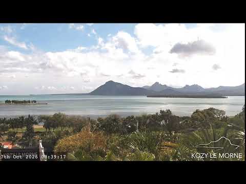
Le Morne Brabant is a peninsula located at the extreme southwestern tip of the Indian Ocean island of Mauritius. It features a prominent basaltic monolith rising 556 metres (1,824 ft) high, with a summit covering over 12 hectares (30 acres). The area is largely surrounded by a lagoon and benefits from a distinct micro-climate that supports unique vegetation.
The mountain derives its name from the Dutch East India Company ship Brabant, which ran aground on the site on 29 December 1783. In the early 19th century, it served as a refuge for Maroons and escaped slaves. Following the abolition of slavery on 1 February 1835, legend holds that former slaves leaped to their deaths rather than face re-enslavement. UNESCO added the site to the World Heritage List in 2008.
The landscape is defined by steep slopes containing many caves and overhangs, along with the imposing monolith itself. It serves as a refuge for two rare plants, the Mandrinette and the Boucle d'Oreille. The monument includes an inscription from Richard Sedley Assonne's poem highlighting the historical significance of slavery and the choice of death over chains.
The site is a well-known tourist attraction and a powerful symbol of resistance against slavery. It highlights the historical significance of the region, particularly for Mauritian Creoles who celebrate the Annual Commemoration of the Abolition of Slavery on 1 February. Visitors can hike the challenging 3.5-kilometre trail to the top or engage in kitesurfing in the surrounding lagoon.
Access is available via a car park at the bottom, with driving directions generally leading south from Flic en Flac. The hike to the summit takes approximately three to four hours and is considered somewhat challenging due to steep and rocky terrain. The area is often cited as the location of an underwater waterfall phenomenon off its coast.
 The EARF Engine