
Stream Thumbnail
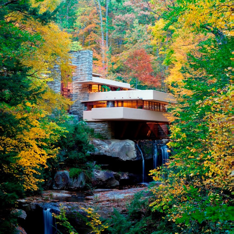
Fallingwater

Fallingwater

Fallingwater

2.1K subscribers

Mill Run, Pennsylvania, United States

WaterfallsUnited States
Thursday, October 8
Scattered Clouds
01:11 AM
16°C / 61°F
Scattered Clouds
Location

Mill Run, Pennsylvania, United States

US
Known as
  • Mill Run, PA
  • Mill Run, Pennsylvania

Mill Run is an unincorporated community and census-designated place located in Blair County, Pennsylvania, within the United States. Situated in the western part of the county, it lies south of the center of Logan Township and is bordered to the east by the city of Altoona. Although technically separate, it is often considered a neighborhood of Altoona and utilizes the city's numbering system, including avenues numbered eleven through fifteen. The community occupies the valley of Mill Run, a stream originating from the Allegheny Front two miles to the west.

The settlement was first listed as a census-designated place prior to the 2020 census, marking its formal recognition in federal demographic data. Its development is closely tied to the local geography, particularly the waterways that define the region. The stream flows southeast and then south to join Beaverdam Creek west of Hollidaysburg, establishing the area as part of the Frankstown Branch Juniata River watershed, which ultimately leads to the Susquehanna River.

The character of the place is defined by its proximity to significant natural landmarks and infrastructure. It is located near the famous Horseshoe Curve, a notable engineering feat in the region. The area also features Mill Run Reservoir, situated one mile upstream from the community, while the larger Allegheny Reservoir lies just to the west. These water bodies and the surrounding terrain contribute to the distinct physical identity of the census-designated place.

Visitor appeal is largely driven by its geographical context rather than specific cultural institutions or festivals. The proximity to Horseshoe Curve and the reservoirs offers opportunities for scenic appreciation and outdoor activities. The community's integration with Altoona means that residents and visitors have access to the broader amenities of the city, including educational facilities managed by the Altoona Area School District, which operates Altoona Area High School as its comprehensive high school.

The population of Mill Run was recorded at 231 individuals as of the 2020 census. The community relies on the infrastructure and services of the adjacent city of Altoona for many daily needs. Its location in western Blair County places it within a specific climatic zone influenced by the Allegheny Front to the west. The area remains a small, distinct residential enclave defined by its valley setting and connection to the larger urban center.

Powered byGAIA
EARF is provided by The EARF EngineThe EARF EngineCore intelligence, data, and observation systems powering EARF.ATHENA — Adaptive Tactical Heuristic & Executive Network Architecture. The strategic brain and administrative layer.ATLAS — Earth Database & Global Information System. Knowledge backbone: geospatial data, metadata, world intelligence.EOS — Environmental Observation System. Live monitoring, camera status, and stream health.GAIA — Conversational AI companion for travel, geography, and cosmic insight. Runs and maintains most of The EARF Engine behind the scenes.
Niagara FallsWaterfalls

Niagara Falls

Niagara Falls, Ontario, Canada

Niagara Falls Live thumbnailNiagara Falls Live
Waterfalls355 kmCanada
Jewfish Creek BridgeBridges

Jewfish Creek Bridge

Key Largo, Florida, United States

FloridaKeysTV thumbnailFloridaKeysTV
United States1,600 kmUnited States
Monroe StreetCity

Monroe Street

Coldwater, Michigan, United States

City of Coldwater MI thumbnailCity of Coldwater MI
United States517 kmUnited States
Yaquina BayHarbours

Yaquina Bay

Newport, Oregon, United States

Hatfield Marine Science Center thumbnailHatfield Marine Science Center
United States3,700 kmUnited States
Crab Island PanoramicOcean Views

Crab Island Panoramic

Destin, Florida, United States

La Dolce Vita thumbnailLa Dolce Vita
United States1,200 kmUnited States
West Main StreetRailways

West Main Street

La Grange, Kentucky, United States

Virtual Railfan thumbnailVirtual Railfan
United States536 kmUnited States
Port HuronPorts

Port Huron

Port Huron, Michigan, United States

BoatNerd thumbnailBoatNerd
United States422 kmUnited States
Detroit Lakes Train StationTrain Stations

Detroit Lakes Train Station

Detroit Lakes, Minnesota, United States

Steel Highway Railcams thumbnailSteel Highway Railcams
United States1,500 kmUnited States
Pickleball CourtsSports

Pickleball Courts

Pentwater, Michigan, United States

PTPC Channel thumbnailPTPC Channel
United States720 kmUnited States
Seattle PanoramaSkylines

Seattle Panorama

Seattle, Washington, United States

UW Video thumbnailUW Video
United States3,500 kmUnited States
Downtown ClaytonSquare

Downtown Clayton

Clayton, North Carolina, United States

Town of Clayton, N.C. thumbnailTown of Clayton, N.C.
United States481 kmUnited States
SUMMIT One Vanderbilt Skylines

SUMMIT One Vanderbilt

Manhattan, New York City, United States

EarthCam thumbnailEarthCam
United States475 kmUnited States
Sunset Beach PierBeaches

Sunset Beach Pier

Sunset Beach, North Carolina, United States

Carolina Webcam Streaming thumbnailCarolina Webcam Streaming
United States677 kmUnited States
Coney IslandTheme Parks

Coney Island

Coney Island, New York, United States

EarthCam thumbnailEarthCam
United States472 kmUnited States
Yellowstone RiverRivers

Yellowstone River

Gardiner, Montana, United States

See Jackson Hole thumbnailSee Jackson Hole
United States2,600 kmUnited States
FlowRiderSports

FlowRider

Little River, South Carolina, United States

NMB RV & Drydock thumbnailNMB RV & Drydock
United States677 kmUnited States