










Europe
Bosnia and Herzegovina
"The heart shaped land"
Overview
Bosnia and Herzegovina is a country located in the Balkan Peninsula of Southeast Europe. It is bordered by Croatia to the north and southwest, Montenegro to the southeast, and Serbia to the east. The nation's geography is characterized by a mix of mountainous terrain, with the rugged Dinaric Alps dominating the landscape. While historically known for its diverse ethnic and religious populations, the country's modern identity is defined by its complex post-Yugoslav history. The capital, Sarajevo, serves as the primary urban and cultural center, situated in a valley surrounded by mountains. The country's economy relies on a mix of agriculture, light industry, and services, though it faces significant challenges in stability and development.
Travel Advisory
Government & Politics
| Government Type | Highly decentralized federal state |
|---|---|
| System | Republic |
| President | Denis Bećirović (Chairman of Presidency) |
| Prime Minister | Borjana Krišto |
| Legislature (Bicameral (House of Peoples and House of Representatives)) | Parliament of Bosnia and Herzegovina |
| Independence | 1992-02-02 from Yugoslavia (De facto) |
| Constitution | 1992 |
Bosnia and Herzegovina operates as a highly decentralized state, structured into two entities (the Federation of Bosnia and Herzegovina and the Republika Srpska). The constitution is complex, reflecting the need to balance the rights and autonomy of its three main constituent peoples (Bosniaks, Serbs, and Croats). This structure, while designed to ensure minority rights, has often led to political gridlock and challenges in governance and economic reform.
The country maintains close economic and political ties with Western European nations, particularly those within the EU and NATO. Its foreign policy is heavily influenced by the need for international mediation and support to navigate its internal political divisions. Relations with neighboring states, especially Serbia and Croatia, are crucial for trade and regional stability.
People, Language & Religion
| Official Languages | Bosnian |
|---|---|
| National Languages | Serbian |
| Regional Languages | Croatian |
| Native Name BOS | Bosna i Hercegovina |
| Native Name HRV | Bosna i Hercegovina |
| Native Name SRP | Босна и Херцеговина |
| Demonym (Male) | Bosnian, Herzegovinian |
| Ethnic — Serbs | Approx. 30% |
| Ethnic — Croats | Approx. 18% |
| Ethnic — Others | Approx. 10% |
| Ethnic — Bosniaks | Approx. 42% |
| Religion — Islam | Majority (Bosniaks) |
| Religion — Catholicism | Significant (Croats) |
| Religion — Orthodox Christianity | Significant (Serbs) |
Economy
| GDP (Nominal) | $32.6B USD |
|---|---|
| GDP (PPP) | $81.1B USD |
| GDP per Capita | $10,382 USD |
| GDP per Capita (PPP) | $25,814 USD |
| GDP Growth Rate | 2% |
| Gini Coefficient | 0.303 |
| Human Development Index 0.635 · Medium | |
| Unemployment Rate | 11% |
| Inflation Rate | 6.1% |
| Public Debt (% GDP) | 39.7% |
| Main Industries | Light manufacturing, Services, Agriculture |
| Main Exports | Machinery, Vehicles, Agricultural products |
| Main Imports | Fuel, Machinery, Consumer goods |
| Export Partners | Croatia, Serbia, Germany |
| Import Partners | Croatia, Serbia, Germany |
| Currency | Bosnia and Herzegovina convertible mark (KM) [BAM] |
Demographics
| Population | 3,140,095 |
|---|---|
| Urban Population | 52.7% |
| Median Age | 35 years |
| Life Expectancy | 78 years |
| Fertility Rate | 1.49 |
| Infant Mortality | 5.5 per 1,000 births |
| Literacy Rate | 98% |
Geography & Climate
Bosnia and Herzegovina is situated in the heart of the Balkan Peninsula, a region known for its complex topography. The country is dominated by the Dinaric Alps, a system of rugged, limestone-karst mountains that run through its length. Major river systems, such as the Neretva, carve through deep valleys, creating a dramatic and varied landscape. The Adriatic Sea provides a limited coastline, primarily accessible through the city of Neum.
| Terrain | Mountainous, karst topography, and river valleys |
|---|---|
| Total Area | 51,209 km² |
| Coastline | 20 km |
| Exclusive Economic Zone | 0 km² |
| Landlocked | No |
| Highest Point | Mount Durmitor (1,677 m) |
| Lowest Point | Adriatic Sea (Neum) (0 m) |
| Major Rivers | Neretva, Sana, Bosna |
| Major Lakes | Lake Zenica |
| Major Cities | Sarajevo, Banja Luka, Mostar |
| Natural Resources | Timber, Mineral deposits (lead, zinc, copper), Agricultural land |
| Climate | Humid Continental / Mediterranean |
The climate varies significantly across the country. The central and eastern regions exhibit a continental climate with cold, snowy winters and hot summers. Conversely, the southern region of Herzegovina possesses a distinct Mediterranean climate, characterized by mild, wet winters and hot, dry summers.
History
Ancient & Early History
The region has been inhabited since prehistoric times and was part of various ancient civilizations, including Illyrian tribes and the Roman Empire. Archaeological evidence points to continuous settlement patterns, making it a crossroads of Mediterranean and Balkan cultures.
Colonial Period
The area was subjected to various empires, including the Byzantine Empire, the Venetian Republic, and the Ottoman Empire. Ottoman rule lasted for several centuries, profoundly influencing the region's demographics, architecture, and religious makeup, leaving a lasting cultural imprint.
Independence
Following the dissolution of Yugoslavia, Bosnia and Herzegovina declared its independence in February 1992. This declaration led to a brutal war (1992–1995) and subsequent international intervention, resulting in the Dayton Peace Agreement.
Modern Era
The modern history is defined by the complex ethnic divisions and the post-war political structure established by the Dayton Accords. The country has struggled with institutional reform, political fragmentation, and the challenges of rebuilding a unified national identity amidst deep historical grievances.
Recent History
The recent decades have seen efforts toward economic stabilization and integration with European structures, particularly through the stabilization and association agreement with the EU. However, political deadlock and institutional weaknesses remain persistent challenges to full development and stability.
Culture & National Symbols
The culture is a rich tapestry woven from Slavic, Ottoman, and Mediterranean influences. Sarajevo, in particular, is renowned for its preserved Austro-Hungarian and Ottoman architecture, creating a unique blend of historical styles. The cuisine is famous for its use of grilled meats and spices, while the traditions reflect the coexistence of multiple faiths.
| National Anthem | Himna Bosne i Hercegovine — "Bosna i Hercegovina, naša domovina" |
|---|---|
| National Sport | Football (Soccer) |
| National Dish | Ćevapi |
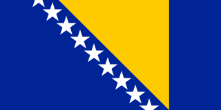
| National Colours | Blue, White, Green |
Cuisine
- Ćevapi (grilled minced meat)
- Burek (savory pastry)
- Bosnian coffee culture
Tourism Highlights
- Mostar's Stari Most (Old Bridge)
- Sarajevo's Baščaršija (Old Bazaar)
- The natural beauty of the Herzegovina region
Natural Wonders
- Durmitor National Park
- Neretva River Canyon
Notable People
Emir Hadžihuseinović, Mehmed Paša Sokolović
Fun Facts
- The country's name is derived from the Slavic root 'bos' (forest/wood) and 'herceg' (prince/duke).
Military
| Branches | Army of Bosnia and Herzegovina, Police Forces |
|---|---|
| Personnel (Approx.) | 11,000 |
International Relations
| UN Member Since | 1992 |
|---|---|
| Organizations | Council of Europe, OSCE |
| UNESCO Sites | 1 — Stari Most (Old Bridge) in Mostar |
Infrastructure & Environment
| Driving Side | Right |
|---|---|
| Electrical | 230V, 50 Hz (Type F (Schuko)) |
| Internet Users | 86.1% |
| Mobile Subscriptions | 121.2 per 100 people |
| CO₂ Emissions | 20.4 Mt |
| Renewable Energy | 36.6% |
Environmental Issues
- Deforestation and illegal logging
- Water pollution in major river systems
- Impact of karst topography on biodiversity
Communications
| International Calling Code | +387 |
|---|---|
| Internet TLD | .ba |
| Postal Code Format | ##### |
Emergency Services
External Links


 The EARF Engine