










South America
Peru
Republic of Peru
"Firm and happy for the union"
Overview
The Republic of Peru is a sovereign nation located in the western part of South America. It is bordered by Ecuador and Colombia to the north, Brazil to the east, Bolivia to the southeast, Chile to the south, and Ecuador to the northwest. Peru is renowned for its extreme biodiversity, featuring diverse ecosystems that range from the arid coastal desert and the towering peaks of the Andes Mountains to the vast, humid rainforests of the Amazon basin. With a population exceeding 32 million people, the country's capital and largest urban center is Lima. Covering an area of 1,285,216 km², Peru is the third-largest country in South America and a major cultural and historical crossroads.
Travel Advisory
Government & Politics
| Government Type | Unitary Presidential Republic |
|---|---|
| System | Republic |
| President | José María Balcázar |
| President | José María Balcázar |
| Legislature (Unicameral) | Congress of the Republic |
| Independence | 1824-07-28 from Spanish Empire |
| Constitution | 1979 |
Peru operates as a unitary presidential republic with a history marked by political volatility. The government structure involves a President, who serves as both head of state and head of government, and a unicameral Congress. Political stability remains a challenge, often resulting in changes in leadership and constitutional crises. The political landscape is influenced by regionalism and the powerful economic interests of the mining sector.
Peru maintains strong diplomatic and economic ties with its neighbors, particularly Brazil and Chile. It is a key player in South American trade, leveraging its mineral wealth and Amazonian resources. The country has deepened its partnerships with Asian economies, notably China, for infrastructure and investment, while maintaining traditional ties with the United States.
People, Language & Religion
| Official Languages | Spanish |
|---|---|
| Regional Languages | Quechua, Aymara |
| Native Name AYM | Piruw |
| Native Name QUE | Piruw |
| Native Name SPA | Perú |
| Demonym (Male) | Peruvian |
| Ethnic — black | Descendants of West African slaves. |
| Ethnic — aymara | Indigenous group speaking Aymara, concentrated in the southern highlands. |
| Ethnic — mestizo | Largest group, descendants of European and Indigenous peoples. |
| Ethnic — quechua | Indigenous group speaking Quechua, primarily in the highlands. |
| Religion — Christianity | Predominant religion, primarily Roman Catholicism. |
| Religion — Indigenous Beliefs | Significant presence, particularly in rural and highland areas. |
Economy
| GDP (Nominal) | $334.9B USD |
|---|---|
| GDP (PPP) | $650.6B USD |
| GDP per Capita | $9,684 USD |
| GDP per Capita (PPP) | $18,816 USD |
| GDP Growth Rate | 3.5% |
| Gini Coefficient | 0.401 |
| Human Development Index 0.735 · High | |
| Unemployment Rate | 5.1% |
| Inflation Rate | 1.5% |
| Public Debt (% GDP) | 35.2% |
| Main Industries | Mining (Copper, Gold), Agriculture (Potatoes, Quinoa, Cocoa), Tourism, Fishing |
| Main Exports | Copper, Gold, Zinc, Fishmeal, Cocoa |
| Main Imports | Fuel oil, Machinery, Chemicals, Foodstuffs |
| Export Partners | China, United States, Japan |
| Import Partners | China, United States, Brazil |
| Currency | Peruvian sol (S/) [PEN] |
Demographics
| Population | 34,576,665 |
|---|---|
| Urban Population | 85.6% |
| Median Age | 19 years |
| Life Expectancy | 77.9 years |
| Fertility Rate | 1.97 |
| Infant Mortality | 11 per 1,000 births |
| Literacy Rate | 93.7% |
Geography & Climate
Peru's geography is defined by three major parallel ecological zones: the Pacific Coastal Desert, the towering Andes Mountain Range, and the Amazon Rainforest. The Andes, which stretch for over 1,000 km, are home to the highest peaks in the region. The Amazon basin represents the largest tropical rainforest area in the country, while the Pacific coast is marked by dry, sparsely populated plains.
| Terrain | Coastal desert, high Andean mountains, and Amazonian rainforest. |
|---|---|
| Total Area | 1,285,216 km² |
| Coastline | 2,400 km |
| Exclusive Economic Zone | 2,400,000 km² |
| Landlocked | No |
| Highest Point | Huascarán (6,768 m) |
| Lowest Point | Mar Negro (Black Sea) (0 m) |
| Major Rivers | Amazon River, Río Marañón, Río Ucayali |
| Major Lakes | Lake Titicaca (shared with Bolivia) |
| Major Cities | Lima, Arequipa, Trujillo, Cusco |
| Natural Resources | Copper, Gold, Silver, Zinc, Petroleum, Forestry products |
| Climate | Tropical/Arid/Alpine |
Peru exhibits extreme climatic variation due to its diverse geography. The northern coast is characterized by an arid desert climate, while the central coast is semi-arid. The Andes mountains feature alpine and temperate climates, with dramatic temperature shifts at altitude. To the east, the Amazon basin maintains a humid tropical rainforest climate.
History
Ancient & Early History
The Peruvian coast and highlands were home to sophisticated pre-Inca civilizations. Notable cultures include the Chavín culture (c. 900–200 BCE), which established early religious centers, and the Moche culture (c. 100–800 CE), famous for its elaborate pottery and metallurgy. The Paracas culture also left behind significant textile remains.
Colonial Period
The region was conquered by the Spanish Empire in the 16th century, leading to the establishment of a viceroyalty. The colonial period saw the exploitation of mineral wealth, particularly silver and gold, which fueled the development of major urban centers like Lima. This era profoundly shaped the country's social and economic structures.
Independence
The struggle for independence gained momentum in the early 19th century. Key figures like José de San Martín and Simón Bolívar played crucial roles in liberating the territory from Spanish rule, culminating in the declaration of independence in 1821 and formal recognition in 1824.
Modern Era
The 19th and 20th centuries saw Peru navigate periods of internal conflict and external intervention. The country experienced various civil wars and political instability, often tied to the struggle between regional elites and central government authority. The mid-20th century saw attempts at modernization and economic diversification.
Recent History
In recent decades, Peru has focused on stabilizing its political system while capitalizing on its natural resources and tourism potential. The government has implemented reforms aimed at improving infrastructure and managing the complex relationship between mining interests and environmental conservation.
Culture & National Symbols
Peru is a cradle of pre-Columbian civilization, evidenced by monumental sites like Caral-Supe. Its culture is a rich blend of Andean traditions, Spanish colonial influences, and Amazonian influences. The country is celebrated for its vibrant festivals, traditional music, and the preservation of ancient indigenous customs.
| National Anthem | Himno Nacional del Perú — "Somos libres, seámoslo siempre..." |
|---|---|
| National Animal | Andean Condor |
| National Bird | Andean Condor |
| National Flower | Orchid |
| National Tree | Cinchona Tree |
| National Sport | Football (Soccer) |
| National Dish | Ceviche |
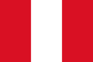
| National Colours | Red, White |
Cuisine
- Ceviche (raw fish marinated in citrus)
- Lomo Saltado (stir-fried beef)
- Aji de Gallina (creamy chicken stew)
Tourism Highlights
- Machu Picchu (Inca citadel)
- Lake Titicaca (highest navigable lake)
- Sacred Valley (agricultural terraces and ruins)
Natural Wonders
- Amazon Rainforest
- Colca Canyon (deepest canyon in the world)
- Manu National Park
Notable People
Mario Vargas Llosa, César Vallejo, Alfredo Bryce Echenique
Fun Facts
- Peru is home to the world's deepest canyon, the Colca Canyon.
- The Inca civilization flourished in the Andes mountains, leaving behind sophisticated engineering feats.
Military
| Branches | Army, Navy, Air Force |
|---|---|
| Personnel (Approx.) | 158,000 |
International Relations
| UN Member Since | 1961 |
|---|---|
| Organizations | Non-Aligned Movement (NAM) |
| UNESCO Sites | 13 — Machu Picchu, Historic Centre of Cusco, Chan Chan Archaeological Zone |
Infrastructure & Environment
| Driving Side | Right |
|---|---|
| Electrical | 220V, 60 Hz (Type A, Type C) |
| Internet Users | 82% |
| Mobile Subscriptions | 124.6 per 100 people |
| CO₂ Emissions | 69.3 Mt |
| Renewable Energy | 30.6% |
Environmental Issues
- Illegal mining and mercury contamination
- Deforestation in the Amazon basin
- Coastal desertification
Communications
| International Calling Code | +51 |
|---|---|
| Internet TLD | .pe |
| Postal Code Format | ##### |
Emergency Services
External Links



 The EARF Engine