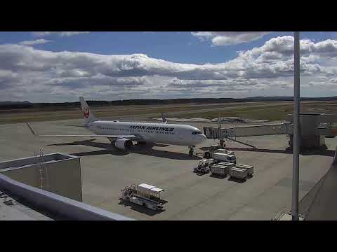


Tokachi-Obihiro Airport
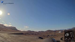
This live stream shows Tokachi-Obihiro Airport, a regional airport located 25 kilometers south of Obihiro in eastern Hokkaido, Japan's northernmost main island. Opened in March 1981 with a 2,500-meter runway, the airport serves as the gateway to the Tokachi region, Japan's food supply base with a food self-sufficiency rate of 1,100%. The airport offers multiple daily flights to Tokyo Haneda via Japan Airlines, ANA, and Air Do, plus seasonal routes to Nagoya Centrair and international flights to South Korea.
Obihiro, Hokkaido, Japan
 JP
JP- 帯広市
- Obihiro, Hokkaido
Obihiro is a city situated in the Tokachi Subprefecture of Hokkaido, Japan, serving as the administrative capital of the region. Located in southeastern Hokkaido, it sits almost centrally within the expansive Tokachi Plain, with its boundaries extending into the southwestern mountainous region designated as Hidakasanmyaku-Erimo-Tokachi National Park. The city is defined by its position on this major agricultural plain, where approximately half of the land is utilized for large-scale field cropping. It acts as a central hub for the surrounding municipalities, including Otofuke, Memuro, and Sarabetsu, within the broader context of Japan's northernmost main island.
The area was first settled by Yoda Benzō and his Banseisha pioneers in May 1883, arriving at the location then known as Opereperekepu. Following the construction of the first road and bridges in 1886, the settlement grew steadily, establishing its first post office in 1892 and receiving electric lights in 1914. Obihiro officially became a municipality on April 1, 1933, with Moriharu Watanabe serving as its first mayor. Its current size was largely determined by the 1957 merger of the villages of Taishō and Kawanishi. In 2008, the city was designated a model environmental city in recognition of its conservation efforts.
The city is arranged on a regular north-south grid, with most of its urban area lying in the southwestern quadrant. Two main features cut diagonally across this grid: the railway line containing the main JR station and Midorigaoka Park, a green hill hosting key attractions like the museum and zoo. The urban landscape includes a few distinctive pachinko palaces and is characterized by car dealerships and numerous cake shops. To the north, the Tokachi River flows through the city limits, while the Satsunai River, known for its pristine water quality, runs through the area, providing most of the city's drinking water.
Obihiro serves as a gateway to major natural attractions such as the high volcanic peaks of Daisetsuzan and the wildlife-rich Shiretoko Peninsula, bypassing Sapporo for visitors seeking alpine flora. The city itself draws tourists with its dairy farms, which inspire a local culture centered on pastry and cookies, supported by the headquarters of renowned companies like Rokkatei and Ryugetsu. Cultural institutions include the Hokkaido Obihiro Museum of Art and the Obihiro no Mori recreation space, created through decades of community tree planting. The city also hosts the Rally Japan World Rally Championship event.
As of 31 December 2025, the city had an estimated population of 159,294 in 90,105 households, with a density of 257 people per square kilometer. The economy is heavily agricultural, featuring farms with average arable land exceeding national averages, producing wheat, potatoes, and beets. Transportation access is provided by Tokachi-Obihiro Airport to the south and JR Hokkaido's Nemuro Main Line. Obihiro experiences a humid continental climate with warm summers and cold winters, similar to New England, with precipitation falling throughout the year but peaking in late summer.
 The EARF Engine






![[公式]スターキャット thumbnail](https://yt3.ggpht.com/HctH3nbthpSnqkSmip0mKd58sfF8jrSu-3nQQPGjNXZrZ6-M1aWifq38wUMqEBgM31B8Qz08=s800-c-k-c0x00ffffff-no-rj)