

Uruapan Skyline
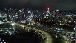
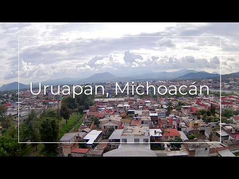
This live stream offers a wide view over Uruapan, a vibrant city located in the highlands of Michoacán, Mexico. Broadcasting from the IMPLAN facility, the camera captures the urban landscape of one of the state's key economic and cultural centers. Uruapan is known for its lush surroundings, avocado production, and historical charm. In the distance, you can spot the city's modern skyline mixed with traditional residential neighborhoods, providing a real-time glimpse into local life in central Mexico.
Uruapan, Michoacán, Mexico
 MX
MX- Uruapan del Progreso
Uruapan del Progreso is the second largest city in the Mexican state of Michoacán, situated at the western edge of the Purépecha highlands near the Tierra Caliente region. It serves as the seat of a municipality that extends over 954.17 square kilometers, governing surrounding agricultural and forestry communities. The urban center lies at an elevation of 1,620 meters above sea level, positioned strategically to facilitate regional trade and administration within this central Mexican state.
The city was conquered by the Spanish in 1522 after the last Purépecha ruler fled from Pátzcuaro. Its modern layout was established in 1534 by Friar Juan de San Miguel, who also founded the first hospital in the Americas in 1533. Uruapan played a significant role in the War of Independence and served as the capital of Michoacán during the French Intervention, evolving from a colonial administrative hub into a major economic center.
The city center features colonial architecture with Plateresque and Moorish elements, anchored by the Plaza de Martires de Uruapan. Key landmarks include the La Huatápera Museum, built over a pre-Hispanic platform, and the Immaculate Concepción church. The western side hosts Barranca del Cupatitzio National Park, known for its ancient trees and waterfalls, while the San Pedro Factory remains an operational textile mill from the late nineteenth century.
Cultural life revolves around six historic neighborhoods, each celebrating unique festivals with traditional dances like Los Negritos. The city is renowned for its cuisine, including corundas and churipo, and hosts the Palm Sunday Handcraft Market and an Avocado Festival. Visitors are drawn to the local crafts, the world capital status of its avocado distribution industry, and the opportunity to explore indigenous heritage at the Museo de los Cuatro Pueblos Indios.
The city has a population of 334,749 as of 2015, with the municipality housing over 315,000 residents. It is the economic heart of Mexico's avocado growing region, supported by six packing companies that distribute crops globally. Accessible via Uruapan International Airport and motorways connecting to Morelia and Zamora, the area offers a mild climate suitable for year-round tourism focused on agriculture and history.
 The EARF Engine