
Três Outeiros
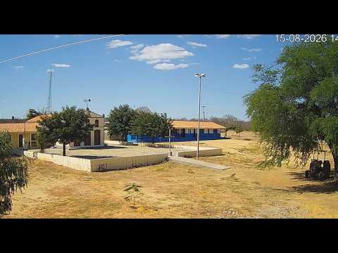
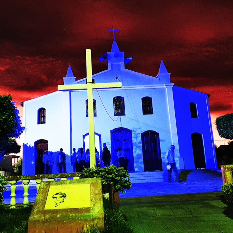
This live stream provides a view of the Três Outeiros Church and School in Macaúbas, Bahia, Brazil. The camera overlooks the local church and school buildings, with the surrounding community and streets visible around the site. Três Outeiros is part of the municipality of Macaúbas in Bahia's interior, where small rural communities are surrounded by the dry landscapes and rolling terrain characteristic of the region. The church and school serve as prominent local landmarks within the settlement. The live view captures everyday activity around the church and school, with local movement and changing weather conditions visible throughout the day. The surrounding landscape also provides a real-time look at the rural character of this part of Bahia.
Macaúbas, Bahia, Brazil
 BR
BR- Macaúbas
- Macaubas
- Município de Macaúbas
Macaúbas is a municipality in the state of Bahia, Brazil, located in the interior of the state within the semi-arid region of the Sertão. The municipality is characterized by a landscape of dry hills, rocky outcrops, open vegetation and agricultural areas, reflecting the climatic conditions of northeastern Brazil. Its territory forms part of the broader transition between the Caatinga landscapes of the Sertão and the higher, more humid terrain of the surrounding Chapada Diamantina region.
The natural environment around Macaúbas is strongly influenced by seasonal rainfall, with much of the vegetation adapted to long dry periods followed by short periods of heavier rain. Native Caatinga vegetation includes thorny shrubs, small trees, cacti and other drought-resistant plants, while valleys and areas around waterways can support denser vegetation. The changing seasons can produce a dramatic contrast between the dry, muted landscape and the greener countryside that appears following rainfall.
Macaúbas has a predominantly rural landscape outside its urban center, with farms, small agricultural properties and scattered communities extending across the surrounding hills and valleys. Agriculture and livestock have historically been important to the local economy, with production shaped by the region's semi-arid conditions and availability of water. Traditional rural settlements and roads connect the municipality's communities with the main town and neighboring areas of Bahia.
The municipality also has a long history connected with the development of the interior of Bahia. Its settlement grew as agricultural and trading communities expanded through the Sertão, and the town became a regional center for surrounding rural populations. Traditional churches, public buildings and other elements of the historic urban landscape reflect the cultural development of the municipality and the wider sertanejo communities of inland Bahia.
The surrounding terrain includes low mountain ranges, rocky hills and valleys that provide scenic views across the semi-arid countryside. Seasonal streams and small waterways shape parts of the landscape, while higher ground can offer broad views over the Caatinga and agricultural areas. The region's geology and vegetation contribute to the rugged appearance typical of the interior of Bahia, with exposed rock and dry woodland appearing alongside cultivated land.
Macaúbas also reflects the cultural character of Bahia's interior, where local traditions, rural life, religious celebrations and regional cuisine form important parts of community identity. The town functions as a service and commercial center for surrounding rural settlements, providing markets, schools, healthcare and other services to the wider municipality.
Today, Macaúbas combines a small regional urban center with an extensive rural territory shaped by the climate and landscapes of the Bahian Sertão. Its dry hills, Caatinga vegetation, agricultural communities and seasonal waterways provide a distinctive view of inland northeastern Brazil, while its location near the higher landscapes of central Bahia connects it with the broader geographic and cultural diversity of the state.
 The EARF Engine