

Sam Sharpe Square
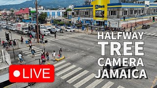
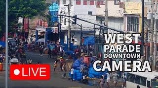
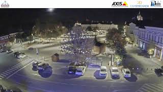
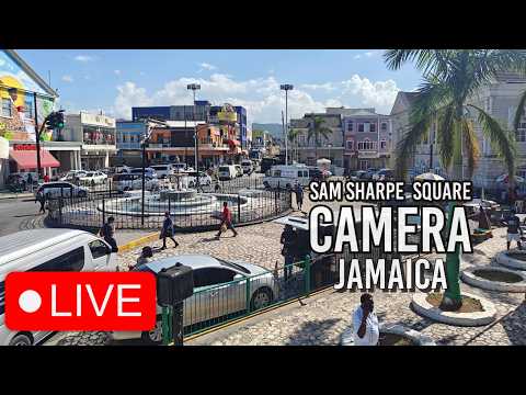
This live camera from See Jamaica looks out across Sam Sharpe Square in the centre of downtown Montego Bay, the capital of St James Parish and the country’s second-largest city, with a population of around 110,000. At the heart of the square is an ornamental fountain enclosed by cast iron railings, set against cobblestone paving and surrounded by colonial-era commercial buildings. These features reflect Montego Bay’s long history as a trading hub, dating back to the British establishment of sugar plantations across St James Parish in the 17th century. The Scotiabank branch visible on the left occupies one of the square’s key commercial corners. Today, the space functions both as a pedestrian gathering point and a busy road junction, with constant vehicle movement and route taxis passing through. The square is named after Samuel Sharpe, a Baptist deacon and National Hero of Jamaica who organised the Baptist War, also known as the Christmas Rebellion. This was the largest slave uprising in Jamaican history, involving an estimated 60,000 enslaved people across the western parishes. Sharpe was executed in Montego Bay on 23 May 1832, and his actions are widely regarded as a key catalyst for the Slavery Abolition Act 1833, which came into force the following year. A bronze statue of Sharpe stands prominently in the square, and his likeness also appears on Jamaica’s 50-dollar banknote. Montego Bay lies on Jamaica’s north-west coast, around 193 kilometres from Kingston, and serves as the island’s main international tourism gateway. Sangster International Airport handles over 4 million passengers annually, making it the busiest airport in the country. Just over a kilometre from the square is the waterfront resort strip known as the Hip Strip, while the downtown area seen in this feed reflects the everyday commercial and civic life of local residents. St James Parish spans approximately 595 square kilometres, covering a mix of inland terrain and coastline that has shaped the region’s economic and cultural role for centuries.
Montego Bay, Saint James, Jamaica
 JM
JM- MoBay
Montego Bay serves as the capital of the parish of St. James in Jamaica, situated on the northwest coast of the island nation. Located roughly ninety minutes west of Kingston, it occupies a broad valley descending from the Bogue, Kempshot, and Salem limestone hills to the Caribbean Sea. The city is enclosed within a watershed drained by rivers such as the Montego River, with its northern boundary marked by Montego Bay Point near the airport.
The area was first inhabited by the Arawak tribe before Christopher Columbus named the bay Golfo de Buen Tiempo in 1494. Spanish rule followed until 1655, when British colonials established the parish of St. James, transforming the region into a major sugar cane producer. The town functioned as a sugarcane port during slavery and was the site of the 1831–1832 Christmas Rebellion led by Samuel Sharpe, who was later proclaimed a national hero.
The city is defined by its coastal resorts, duty-free shopping, and vibrant nightlife along Gloucester Avenue. Notable landmarks include Doctor's Cave Beach, the White Witch's Rose Hall estate with its golf course, and the Montego Bay Convention Centre opened in 2011. The area also features the Montego Bay Marine Park, which protects sixteen square kilometers of bay including Bogue Island, and numerous tourist resorts built on former plantation grounds.
Montego Bay is a popular tourist destination known as the tourist capital of Jamaica, attracting visitors with its beaches, cruise line terminal, and international dining options. The city hosts a diverse population including African, East Indian, Chinese, European, and Hispanic communities, alongside significant American and Canadian residents working in tourism and business process outsourcing. Religious life includes Protestant denominations, Rastafari, and other faiths.
The city has a population of 123,994 as of 2015 and is the second-largest anglophone city in the Caribbean. It serves as a pivotal economic hub for Jamaica's tourism sector, with the Donald Sangster International Airport handling the majority of international arrivals. The tropical climate averages between 23.7°C and 29.8°C, with heavy rainfall occurring seasonally from October to December and mid-April through mid-June.
 The EARF Engine