

Market Square West
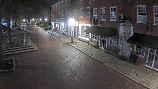
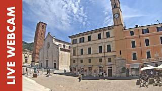
This live stream provides a view of Market Square West in the historic centre of Newburyport, Massachusetts. The camera looks west across Market Square toward Sea Level Oyster Bar and the Firehouse Center for the Arts, with the surrounding historic buildings, businesses and public square visible in the scene. Market Square sits at the intersection of State Street, Merrimack Street and the Inn Street pedestrian walkway, making it a central gathering point in downtown Newburyport. The square is surrounded by preserved historic architecture, restaurants, shops and cultural venues, with pedestrians regularly moving through the area. The live view captures everyday activity in the heart of Newburyport, from people crossing the square to local events and seasonal activity. Its position in the historic downtown also provides a clear look at the character of one of the city's main public spaces.
Newburyport, Massachusetts, United States
 US
US- Newburyport, Massachusetts
- Newbury Port, Massachusetts
Newburyport is a coastal city located in Essex County, Massachusetts, within the United States. Situated approximately 35 miles northeast of Boston, it lies on the elevated south bank of the Merrimack River between the river and the Newbury Marshes. The city forms part of Massachusetts's North Shore region and includes a portion of Plum Island. Its geographic position at the mouth of the Merrimack River defines its coastal character and historical development as a significant maritime hub.
The area originated as part of the town of Newbury until the General Court of Massachusetts passed an act on January 28, 1764, to erect a new town named Newburyport. Approved by Governor Francis Bernard in February 1764, it initially covered 647 acres with a population of 2,800. The settlement prospered and was incorporated as a city in 1851. Its history includes roles in the triangular trade, privateering during the Revolutionary War and War of 1812, and later whaling and clipper ship building, though its maritime infrastructure has largely disappeared.
The city features historic architecture preserved through early 1970s restoration efforts that saved the downtown from demolition. Key landmarks include the Cushing House Museum, a Federal-style home, and the Custom House Maritime Museum housed in an 1835 granite building designed by Robert Mills. The Newburyport Superior Courthouse is the oldest continuously active courthouse in Massachusetts. Residential areas along High Street feature colonial homes with widow's walks, while the ridge top hosts institutions like Newburyport High School and Anna Jaques Hospital.
Newburyport attracts visitors through its vibrant tourism industry, historic seaport atmosphere, and natural areas. The city offers fine dining, water activities, and access to parks such as Maudslay State Park and Joppa Flats Education Center. Cultural interests include the Yankee City anthropological study and literary connections to H.P. Lovecraft's depiction of Innsmouth. The area maintains a strong connection to its maritime past through boatyards and the Newburyport Custom House, which exhibits artifacts from its shipbuilding era.
The population was 18,289 at the 2020 census. The economy relies on tourism, recreational boat maintenance, and an industrial park near the Newbury Marshes. Access is provided by Interstate 95, Interstate 495 nearby, U.S. Route 1, and the MBTA commuter rail from Boston's North Station. Plum Island Airport serves general aviation. The city's location allows for scenic flights and boating trips, with the harbormaster overseeing maritime activity in the often dangerous tidal currents of the Merrimack River.
 The EARF Engine