

English Bay Vancouver
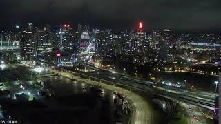
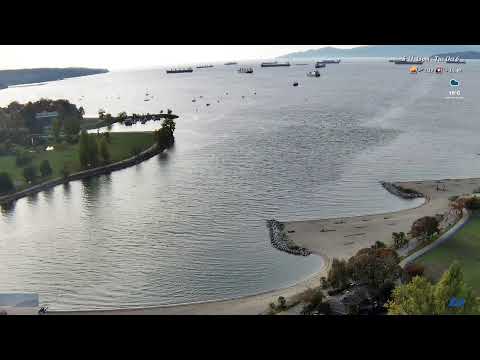
This live moving webcam showcases spectacular panoramic views of English Bay and False Creek from Vancouver's vibrant West End, in the Canadian province of British Columbia. Framed by sparkling waterfronts, sandy beaches, and the city's iconic skyline, the camera captures one of Vancouver's most scenic urban landscapes. In the foreground, you'll see the waterfront surrounding the Vancouver AIDS Memorial, English Bay, and Sunset Beach, where locals and visitors gather to relax, walk, and enjoy the coastal atmosphere. Across False Creek lie Vanier Park, Kitsilano Beach (Kits Beach), the Vancouver Maritime Museum, the Museum of Vancouver, and Burrard Civic Marina, all set against the backdrop of the Coast Mountains. As the camera slowly moves, take in sweeping views across English Bay, the busy waters of False Creek, and the colourful Granville Island Ferries travelling between the city's waterfront destinations. Whether you're watching boats crossing the bay, people enjoying the waterfront, or the changing light throughout the day, this live stream offers a beautiful window into one of Canada's most iconic coastal cities.
Vancouver, British Columbia, Canada
 CA
CA- UBC Vancouver
- UBCV
- Point Grey Campus
The University of British Columbia Vancouver, officially known as the Point Grey campus lands, is an unincorporated area located at the western tip of the Point Grey Peninsula in Metro Vancouver, British Columbia, Canada. It contains the main campus of the University of British Columbia and is bordered solely by the University Endowment Lands, which separate it from the City of Vancouver. As an unincorporated territory, it lacks a municipal government, with its board of governors empowered to adopt land-use plans and manage property rules under the University Act.
The University of British Columbia was established in 1908, with teaching beginning in temporary facilities at the Fairview campus in 1915. The university officially opened its permanent Point Grey campus in 1925, marking the start of significant expansion in academic facilities and residential neighborhoods. Campus development has increasingly been guided by long-term land-use planning, including the adoption of Campus Vision 2050 in July 2024 to frame future academic, housing, and sustainability initiatives while recognizing partnerships with the Musqueam people.
The 402-hectare campus features a street grid organized by east-west roads intersecting north-south malls, with Main Mall and University Boulevard serving as largely pedestrian thoroughfares. Notable sites include the Peter A. Allard School of Law, founded in 1945, and various museums such as the Museum of Anthropology and the Beaty Biodiversity Museum. The area also hosts the Doug Mitchell Thunderbird Sports Centre, built for the 2010 Winter Olympics, and numerous private residential neighborhoods like Wesbrook Place and Hampton Place.
UBC Vancouver serves as a hub for cultural recognition and Indigenous engagement, working in partnership with the Musqueam people on planning and stewardship. The campus offers diverse academic facilities, including the Peter A. Allard School of Law, which specializes in Indigenous and environmental law. Students and visitors can access performing arts theaters like the Chan Centre and the Frederic Wood Theatre, alongside sports facilities for the UBC Thunderbirds teams, creating a vibrant academic and recreational community.
As of the 2021 census, the area has a population of 15,103, which grew by 2,247 between 2016 and 2021 due to residential expansion. The campus is a major destination for TransLink public transit, served by routes such as the 99 B-Line and R4 RapidBus, with long-term plans for the Millennium Line UBC Extension under consideration. For provincial elections, it falls under the Vancouver-Point Grey riding, while federal representation is provided through the Vancouver Quadra electoral riding.
 The EARF Engine